| July
18, 2007
Hello from Ontario: A Driving Tour along
the Niagara Escarpment
Although I love the city the summer always makes me itch to get
out into the country. So I called up my friend Karel with whom I
had helped organize a conference many years ago and asked him if
he would mind getting together in his neck of the woods near Burlington
for a country driving tour of the Niagara Escarpment. Since we had
not seen each other for a couple of years it was a great opportunity
to catch up and enjoy a beautiful drive at the same time.
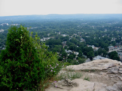
Lookout point at Mount Nemo Conservation area
So we met this morning on a parking lot just off Guelph Line in
the north end of Burlington. I parked my car and off we drove in
Karel’s convertible. We drove north into the green countryside
and up a slope to get to our first destination: a nature area called
the Mount Nemo Conservation Area. We parked the car and walked about
15 minutes eastwards through a forest until we reached a steep cliff
and a lookout point that offered a beautiful 180 degree view over
the rolling farm country that was sprawling far below us.
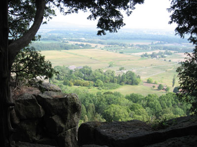
Farmland sprawling below Mount Nemo Conservation Area
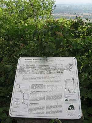
The Niagara Escarpment is a geological formation that extends from
western New York State through Ontario to Michigan, Wisconsin and
Illinois. It originated as a result of unequal erosion where a top
layer of harder and more resistant dolomitic limestone overlays
more easily eroded shale. The gradual erosion of the shale leaves
behind cliffs of resistant cap rock. The limestone itself stems
from an ancient tropical sea and contains some of the most astounding
fossils of the Ordovician-Silurian geological era.
A view of the limestone formations on the Niagara Escarpment
In Ontario, the Niagara Escarpment features the Bruce Trail: Canada’s
oldest and longest footpath that extends over 800 km (with side
trails) from Niagara Falls in the South to Tobermory in the north.
The entire area has been designated a UNESCO World Biosphere Reserve
due to its unique fauna and flora. The Bruce Trail itself is marked
by white blazes (white markings about 8 cm high and 3 cm wide) and
is maintained by the Bruce Trail Association while side trails are
marked by blue blazes.
The ruggedness of the Niagara Escarpment
One of the Niagara Escarpments distinguishing features are the
many lookout points on the rocky outcroppings over an otherwise
rather flat area. In addition, the Niagara Escarpment has dozens
of waterfalls where streams and rivers tumble over the limestone
cliffs. The most famous of these waterfalls is of course Niagara
Falls which is also reachable on a side trail from the Bruce Trail.
Rock faces dropping vertically down
The Niagara Escarpment’s unique natural environment includes
many bird species (some of them endangered) such as the Bald Eagle,
the Red-Shouldered Hawk, the Black Tern and the Hooded Warbler.
Rare reptiles and amphibians also live in the area, for example
the Eastern Massassauga Rattlesnake and the North Dusky Salamander.
37 species of orchids have been found in the northern parts of the
Escarpment, including the Calypso Orchid, the Ram’s-head Lady
Slipper and Alaska Rein Orchid. Considering that about 7 million
people live within close proximity the biological diversity in this
unique area is astounding.
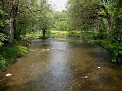
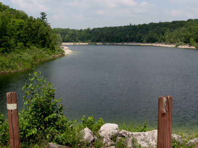
The Sixteen Mile Creek in Lowville
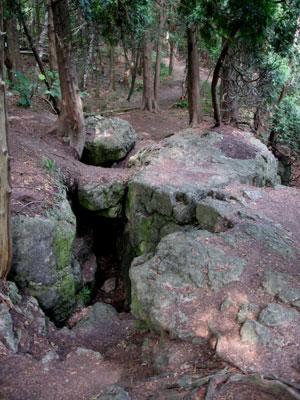
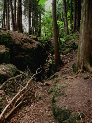
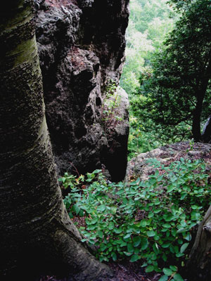
We started walking on a trail right at the edge of a cliff and
Karel informed me that the Niagara Escarpment is extremely popular
with rock climbers. I wanted to take a good snapshot of the cliffs
and crevices, but my fear of heights and the shear vertical drop
prevented me from exploring the very edge of the cliff. The many
caves are also popular with spelunkers. We walked about 20 minutes
northwards and had a beautiful view towards Rattlesnake Point, another
rocky outcrop along the Niagara Escarpment. Then we took a side
trail back through the forest to the parking lot and continued our
drive.
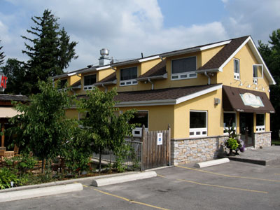
The Lowville Bistro
About ten minutes further north we stopped in the village of Lowville
to have a look at Lowville Park. The Sixteen Mile Creek slowly meanders
through the park and nature trails branch off from the parking lot
area. Right next to the park is the Lowville Bistro, a recently
renovated restaurant that offers upscale casual dining, a licensed
outdoor patio, an ice cream parlour and take-out. The town itself
dates back to the early 1800s and was developed after the Mississauga
Land Purchase. The descendants of some of these early settlers still
live in the village today. 36 historic buildings and a Pioneer Cemetery
still bear witness to this once thriving rural community.
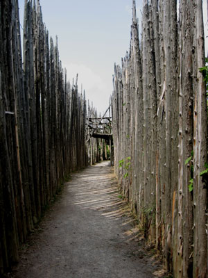
Entrance to the Iroquoian Village at Crawford Lake Conservation
Area
Leaving Lowville behind we headed straight north to another conservation
area in the Halton Region Conservation System: Crawford Lake features
a so-called meromictic lake, a deep body of water where different
layers of water do not intermix. This creates an oxygen-poor environment
that is not conducive to living organisms. As a result, archeologists
are able to drill core samples of soil from the lake bed that date
back several centuries. One of these drillings led to the discovery
of corn pollen and the conclusion that there was once an Indian
village in the area. Subsequent archeological digs confirmed the
presence of a native settlement.
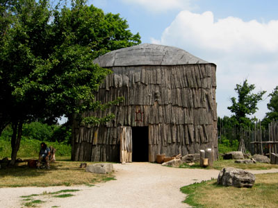
One of the two longhouses
A 15th century pre-contact Iroquoian Village has been reconstructed
on its original site and features two wooden longhouses that contain
sleeping quarters, a fire pit and storage areas for tools, animal
hides and food. Guides provide explanations of the lifestyle of
the Iroquois tribes that inhabited this area. This conservation
area is a popular destination for school children and summer camps
and during our visit several groups of young people were enjoying
themselves in the grassy areas in front of the long houses.
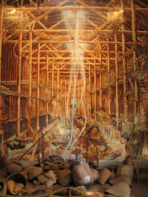
Painting of a longhouse scene
The Niagara Escarpment is just full of protected nature areas,
and just 10 minutes north of the village of Campbellville is another
nature area: the Hilton Falls Conservation Area features excellent
hiking, mountain biking and cross-country ski trails in the area.
More than 30 km of woodland trails weave their way around the Hilton
Falls Reservoir and a 10 metre high waterfall cascades over the
Niagara Escarpment. Across the road from Hilton Falls is the Kelso
/ Glen Eden Conservation Area whose highlights include a sandy beach
as well as 22 kilometres of trails for mountain bikers and 12 slopes
for downhill skiers.
Hilton Falls Reservoir
We continued our drive south to the Town of Milton, which according
to the 2006 Census, is the fastest growing community in Canada.
The population of Milton has grown by more than 70% between 2001
and 2006 and stands about 56,000 people now. Milton dates back to
the 1820s when English settlers Jasper Martin and his wife Sarah
were granted 100 acres of land from the Crown.
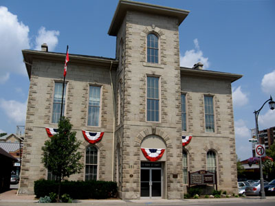
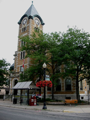
Milton Town Hall
Martin built a grist mill along Sixteen Mile Creek and also created
a pond, Mill Pond, which is still in existence today and has become
a popular recreation area for local residents with its walking trails
and the gazebo that overlooks the water.
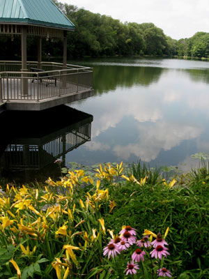
Mill Pond
Main Street in downtown Milton still speaks of its Victorian heritage,
old City Hall, the Post Office Building and several other churches
and secular buildings date back to the mid to late 1800s. Many restaurants
and cafés have sprung up in the downtown core which beckon
visitors to sit down and relax on some of their outdoor patios.
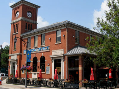
The former Post Office in Milton, now a restaurant
From the quaint town of Milton we headed northwest towards a small
village called Aberfoyle, north of Highway 401. Karel suggested
that we have lunch at the local Aberfoyle Mill, an actual mill that
was converted into a restaurant in 1966. Aberfoyle itself was first
settled in the 1840s and is famous for its Aberfoyle Spring Water.
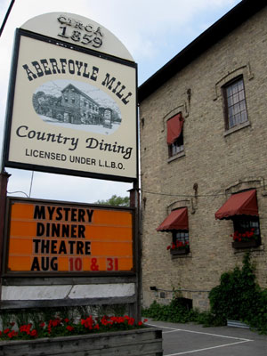
The Aberfoyle Mill
The Aberfoyle Mill itself was built by a Scottish immigrant by
the name of George McLean in 1859 and even won a gold medal for
its oatmeal at the 1867 World’s Fair in Pairs. After stopping
operations in the late 1920s the mill was purchased by the Owens
family in 1960 who then spent six years renovating it and turning
it into one of the most unique country restaurants in Canada.
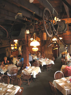
Main dining room at the Aberfoyle Mill
Karel and I sat down at a table on an elevated platform that overlooked
the restaurant. Various farm implements and even an entire sled
were suspended from the ceiling and the mechanism of the old gristmill
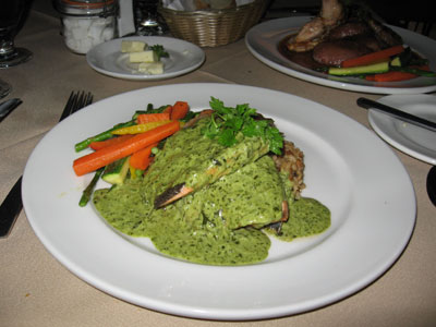
was still visible in a stairway to the basement. I enjoyed a tender
trout filet with garden fresh vegetables and rice while my friend
and tour guide savoured his mixed grill. After our meal we walked
around the entire mill and admired the scenic pond that was home
to a group of Canada geese.
 |
 |
| I had the trout |
Karel's mixed grill |
Then Karel introduced me to another famous destination in Aberfoyle:
the Aberfoyle Antique Market, which although closed today, holds
more than 100 vendors of antiques during market days and has become
an extremely popular weekend destination for collectors.
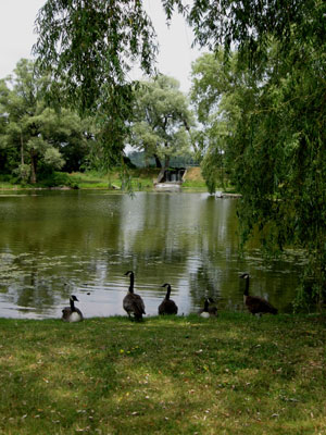
Geese congregate around the pond at the Aberfoyle Mill
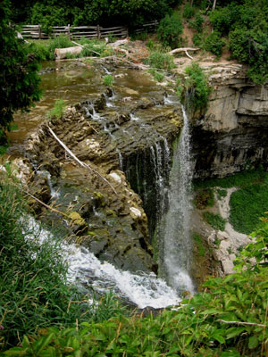
One more nature area remained for us to explore: the Spencer Gorge
Conservation area, north of the City of Hamilton. We parked our
car at the entrance, paid the $5 day use fee by depositing cash
in the self-serve box and started walking on the trail that would
lead us to Dundas Peak. Just about 150 m from the parking lot we
stopped to admire Tews Falls, a waterfall with a height of 41 m
that is almost as high as Niagara Falls. The water level was pretty
low since we have not had any significant rain fall in a while,
but I could only imagine how picturesque this waterfall must be
when the water level is higher.
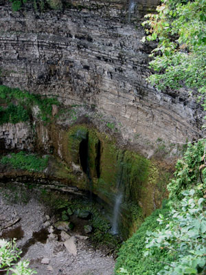
Not much water at Tew's Falls
A serene 20 minute hike with occasional views past the lush green
trees into the Gorge took us to Dundas Peak, an elevated cliff with
a platform of natural stone that provides a magnificent view of
the Town of Dundas, the City of Hamilton and the Niagara Escarpment
which encircles the entire area. The rocky platform is an overhang
and with my fear of heights I made sure I stayed about two metres
away from the edge since the edge of the rocks continues into a
sheer vertical drop into the valley.
A view from Dundas Peak
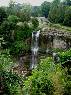
After our hike down we drove just a few minutes to Webster’s
Falls which is also part of the Spencer Gorge Conservation Area.
Another waterfall was enchanting a group of children who were playing
at the bottom of it. Picnic areas and grassy meadows surround the
river on both sides and a unique stone bridge connects the parking
lot with the waterfall.
Webster's Falls
At the end of this 20 minute walk we continued on towards the Town
of Dundas which dates back to 1847. John Graves Simcoe, Lieutenant
Governor of Upper Canada, named the town after Henry Dundas, 1st
Viscount Melville, a good friend of his and a Scottish lawyer and
politician who never even visited North America. Dundas still has
a nice historic core that features an old Post Office and various
other Victorian era buildings.
A close-up of Webster's Falls
Karel proceeded to show me the remainders of the Desjardins Canal,
a historic canal that was completed in 1837 and substantially promoted
the growth of Dundas as a settlement, but was later overshadowed
by the opening of the Great Western Railroad in Hamilton in 1854.
Due to the railway’s stiff competition, the canal fell in
disuse and in 1867 sediment blocked direct access to the town, making
it unusable. Today, the canal has largely been forgotten, but there
are some walking trails along the canal near Cootes Paradise, a
large wetland area at the western end of Hamilton Harbour.
The Post Office in Dundas
It was now after 5 pm and our driving tour had come to an end.
Karel drove me back to my vehicle and I thanked him sincerely for
his time and for sharing his local expertise of the Burlington,
Milton and Dundas areas. We resolved that there were so many interesting
places that we had not seen and that we would do another driving
tour in the area in the next few months.
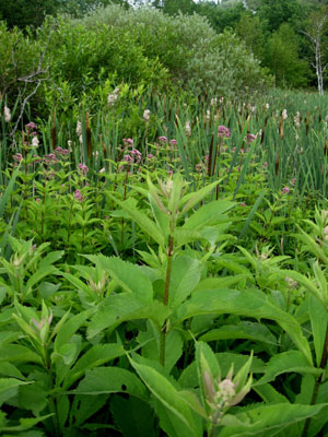
Greenery at the Spencer Falls Conservation Area
I was also a bit tired, but in no mood to get on the Queen Elizabeth
Expressway during rush hour no less. So I drove all the way south
to Lake Ontario and had a quick peek at the Burlington Waterfront
which has been beautifully developed in recent years. Since dark
clouds were starting to roll in I decided to postpone my explorations
of Burlington for next time and embarked on a slow relaxing drive
back to Toronto next to the Lakeshore. The western waterfront of
Lake Ontario is very scenic with multiple public parks and stately
older mansions with beautifully manicured gardens.
Burlington, Oakville and Mississauga will also remain to be explored
next time.
Useful book links:
Related articles:
Hello from
Ontario: Exploring Ontario's waterfront trail - exploring Pickering
and Ajax
Hello from Ontario:
Exploring downtown Barrie and a multicultural connection
Hello from Ontario:
A beautiful winter getaway at Nicholyn Farm Bed and Breakfast
Hello from Ontario:
Snowtubing at Horseshoe Valley and Ontario winter getaways
Hello
from Ontario: A country driving tour through Creemore, Collingwood
& Orillia
Hello from Ontario:
A tour through Niagara Wine Country
Hello from Ontario:
A Kawartha Lakes region tour
Hello from Ontario:
Early fall colours, scarecrows and frogmen in the Kawarthas
Hello from Ontario:
Fall colours, ghosts and ghouls in Caledon, Elora & Guelph
|