| July
12, 2007
Hello from Toronto: A bike ride through
the Don Valley, past the Distillery District to the Toronto Islands
Sometimes you get hooked on an activity, and exploring Toronto
by bike has become one of these pastimes for me. Not only is it
great exercise, but it’s also an awesome way to explore the
nooks and crannies of any destination. To share my enthusiasm I
conscripted my friend Mario on a Thursday evening after work and
persuaded him to come on a cycling trip with me.
So we met up in the Taylor Creek Park system, away from Toronto’s
busy streets and started our ride, heading westwards towards the
Don Valley. We turned southwards and got on the main north-south
bicycle trail that is wedged between the Don Valley Parkway and
the slowly flowing Don River, one of two main rivers in Toronto.
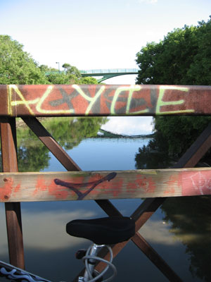
A view from the Don Valley bicycle trail
In my opinion, Toronto is an amazingly cycleable city, it has about
40 km of bicycle lanes on city streets and about 125 km of paved
bicycle paths. What makes Toronto really unique is a network of
ravines that cross the city from north to south, most of which feature
bicycle trails. We cycled underneath the Leaside Bridge, crossed
Pottery Road and stopped briefly underneath the Bloor Viaduct, originally
named the Prince Edward Viaduct System which connects Bloor Street
on the west with Danforth Avenue across the valley of the Don River.
The Don Valley, seemingly miles away from the big city
The Bloor Viaduct is 494 metres long and stands as high as 40 metres
above the Don Valley. The top level of the bridge features six lanes
of traffic, and the second deck holds tracks for Toronto’s
subway system. In recent years the Bloor Viaduct has been equipped
with an expensive suicide barrier to prevent people from jumping
off the bridge. The Bloor Street Viaduct ranked as the second most
fatal free standing structure in the world, after San Francisco’s
Golden Gate Bridge. Since the completion of the C$ 5.5 million suicide
barrier in 2003, also referred to as the ‘Luminuous Veil,
there have not been any suicides at all, and the distinction of
Canada’s leading suicide site has moved to the Jacques Cartier
Bridge in Montreal.
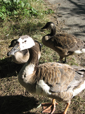
Three geese would like to be fed
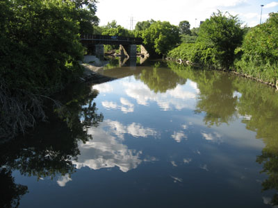
A few hundred metres further south along the trail we stopped on
a narrow bridge and admired the northward and southward view of
the Don River. It sometimes amazes me that there is so much nature
right in the middle of a big metropolis such as Toronto. Three Canada
geese were sitting right next to the pathway and were being fed
by passersby, an example of nature right smack dab in the middle
of a city.
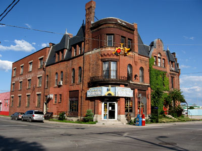
The Canary Restaaurant
Since the bicycle path is blocked off south of Queen Street for
renovations, we had to carry our bikes a few flights of stairs up
to the deck of the Queen Street Bridge from where we continued riding
into the downtown east side of Toronto. We turned south on Cherry
Street and stopped to admire one of the local landmarks: the Canary
Restaurant, located in an unrenovated Victorian brick building at
the intersection of Front and Cherry Streets. The signed said “closed”,
but I wasn’t sure whether this venerable institution was closed
down permanently or just shut for the day.
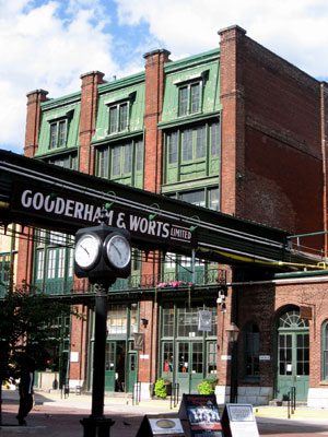
The Distillery Districit
Our next destination was the Distillery District on Mill Street,
a complex of 44 restored Victorian-era industrial heritage buildings
that has been turned into one of Toronto’s most popular entertainment
districts. This area was originally the Gooderham and Worts distillery,
founded in 1832, which became the largest distillery in the world
by the 1860s. Industrial activity declined in the area in the 20th
century and by the early 1990s it was run down and derelict.
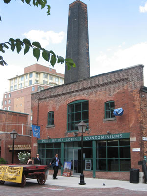
The Distillery District
A group of real estate developers purchased the site in 1990 and
successfully transformed it into the best-preserved collection of
Victorian-era industrial buildings in North America. Today the Distillery
District holds a wide assortment of restaurants, cafes, galleries,
unique retail stores and even a theatre. It has been used as a location
for more than 800 film and television productions including Chicago,
Cinderella Man, Tommy Boy, the Fixer and X Men.
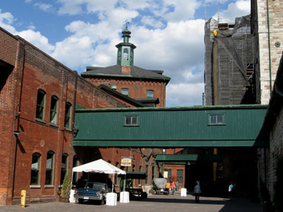
The Distillery District
After heading south on Parliament Street we connected onto the
bicycle lanes on Queens Quay to our next destination: the Toronto
Ferry Terminal at the foot of Bay Street. The Toronto Islands are
a chain of small islands situated off downtown and they provide
a welcome escape from the hustle and bustle of the city. At a price
of C$6 per roundtrip ticket, a ferry ride to the Toronto Islands
provides an affordable getaway into a much more peaceful and quiet
environment.
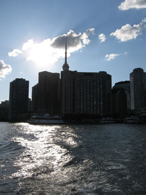
A look back at Toronto from the ferry
Interestingly, the Toronto islands were originally a narrow peninsula
composed of sand that had drifted down from the Scarborough Bluffs.
In 1858 however, water broke through in a violent storm and started
the formation of the “Eastern Gap””, today the
entrance into Toronto’s harbour. Hurricane Hazel also affected
the topographical appearance of the islands and created several
smaller islands. The creation of the Leslie Street spit with fill
from the excavation work for the Toronto subway system stopped the
deposition of additional sediment; however, concrete-reinforced
shorelines limit natural erosion.
Looking at the Ward's Island ferry docks
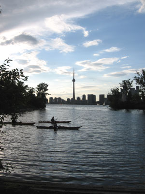
After about a 30 minute wait we hopped onto a small ferry boat
called the Ongiara, a car ferry originally built in 1963. This small
ferry can house a few vehicles and is mostly frequented by bicyclists
who want to explore the island. The view from the rear of the ferry
boat as it recedes from the terminal is simply phenomenal. Toronto’s
impressive skyline featuring the CN Tower, the Rogers Centre and
dozens of commercial and residential high-rise buildings came into
view. Even though I have been living in this city for a long time,
a ride on the ferry and the look back at Toronto’s skyline
are always a special experience.
The clouds are coming in
My friend and I got off the boat at Wards Island, actually an extension
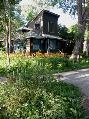
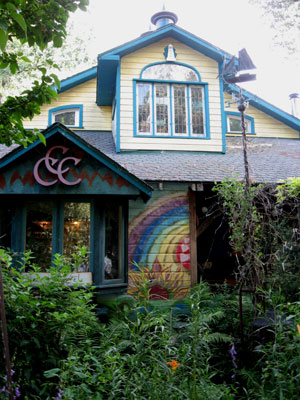
of Centre Island. This area features a cluster of houses and small
cottages that have several hundred permanent residents throughout
the year. The land is owned by the city while the houses are covered
by 99-year leases with the City of Toronto. Many of the cottages
are very small, and not all of them are well-maintained while others
are in great condition and feature impressive gardens.
Residence on Ward's Island
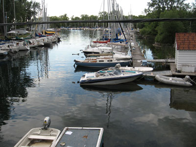
We cycled to the south side of Ward’s Island which features
a wooden boardwalk and a great view of the Leslie Street Spit. From
there we turned right and made our way to Alqonquin Island, another
island that features a community of houses. Altogether the population
of the Toronto Islands comprises about 700 people. We stopped at
a bench on the northern shore of Algonquin Island and sat down to
enjoy the magnificent view of the downtown Toronto skyline. The
bridge over the inner channel provides a perfect view of the tranquil
waterway that is enjoyed by paddlers and sailing boat enthusiasts
alike.
Residence on Ward's Island
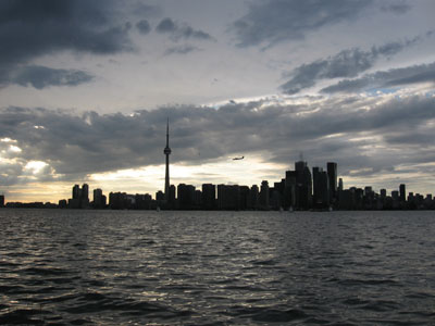
I wish we could have extended our stay on the Toronto Islands,
but dark clouds were looming overhead and it sure looked like we
were going to have a serious thunderstorm. We made our way back
to the Wards Island ferry dock and caught our trusted ferry, but
had to make a detour first to Hanlan’s Point to pick up additional
passengers. Altogether our ferry ride stretched to about 50 minutes
or so, and by the time we arrived at the Bay Street Ferry Terminal,
big raindrops were starting to hit the ground and lightning bolts
were flashing in the sky.
What a great place to admire Toronto's skyline
It was definitely time to get home and quick. My friend and I started
cycling like crazy, but the heavens opened up within a few minutes,
and it started pouring fiercely. We were both soaked and I spent
about 50 minutes cycling in the heavy rain along the Lakeshore and
Beaches bicycle trails to get home.
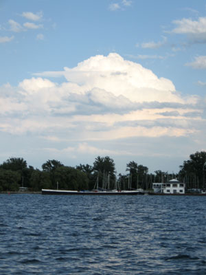
Sailboat harbour on the Islands
But despite the rain, there was something pleasant about the experience,
the rainwater was fairly warm and all the sounds of the city were
nicely muffled by the rain. I was pondering how a long ride in the
rain could be so enjoyable. My only worry was not to get hit by
lightning and about an hour later I had safely made it home, ready
for a hot shower to get all the street grit off my legs.
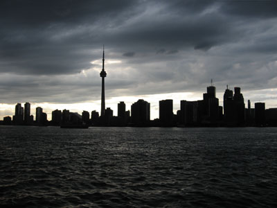
The skies were about to open
As the hot water helped me get rid of the city’s grime I
thought what a great way to explore the city you live in –
a bicycle ride to the Toronto Islands…
Useful books about Toronto:
Related articles:
A cross-city bicycle
tour, Salsa on St. Clair and several free concerts
A walking tour through Toronto's vibrant Chinatown & Kensington
areas
A St. Lawrence culinary
tour with Bruce Bell
Celebrating diversity
with a tour led by Bruce Bell
Toronto's historic
Distillery District with Matthew Rosenblatt
Presenting: Christina
Zeidler and the revitalized Gladstone Hotel
Casa Loma and
the fascinating personality of Sir Henry Pellatt
Exploring the
nooks and crannies of Casa Loma
The historic Royal
York Hotel - one of Toronto's crown jewels
Doors Open 2006, Toronto's
architecture festival
Presenting: the organizers
of Doors Open
|